what do i need to fly here?—Part 4
AS I RETURN to this series following last month’s topic change, I’ll walk through one final scenario and address some of the local complications that can arise, as well as some of the helpful steps that pilots can take to mitigate them.
The focus will be on what is required to operate both legally and responsibly across varying combinations of land use and airspace. Let’s assume that our pilot is already following basic requirements, such as FAA registration, The Recreational UAS Safety Test (TRUST), Remote ID, and an approved safety code.
I’ve explored combinations of public and private land and different classes of airspace. My final example will involve private land within controlled airspace for both individual pilots and those in formal clubs.
Scenario: Private Land, Controlled Airspace
Many pilots operate on property or private land to which they have access. When these areas fall within controlled airspace, some form of FAA authorization is required, as what was discussed in the public land example from the May 2026 issue. Because the pilot owns or has secured access to the land, additional land-use permission should not be needed.
For individual pilots, a Low Altitude Authorization and Notice Capability (LAANC) authorization is typically the most practical option. It can be accessed through a variety of web-based services or mobile apps (such as UASidekick) and provides near-instant approval up to the maximum altitude that is permitted at the selected location. These altitude limits vary depending on proximity to the associated airport, but they generally range from 50 to 400 feet above ground level.
While LAANC provides the airspace authorization you need, there are still practical roadblocks, such as neighbor relations, municipal zoning laws, and proximity to sensitive infrastructure that could complicate day-to-day operations. Pilots should consider that obtaining what’s needed to legally operate won’t necessarily translate to a consistently usable field. Being safe, responsible, and legally compliant is an essential starting point, but if positive local relationships are not maintained, the friction of consistent complaints is more than enough to end a lease or break trust with your landowner.
Clubs that operate in similar environments face many of the same logistical and community challenges. In these cases, an Airspace Authorization is more appropriate than LAANC because of the number of pilots. Airspace Authorization approvals are not automatic like LAANC, but they can provide more operational flexibility pending FAA and control tower review.
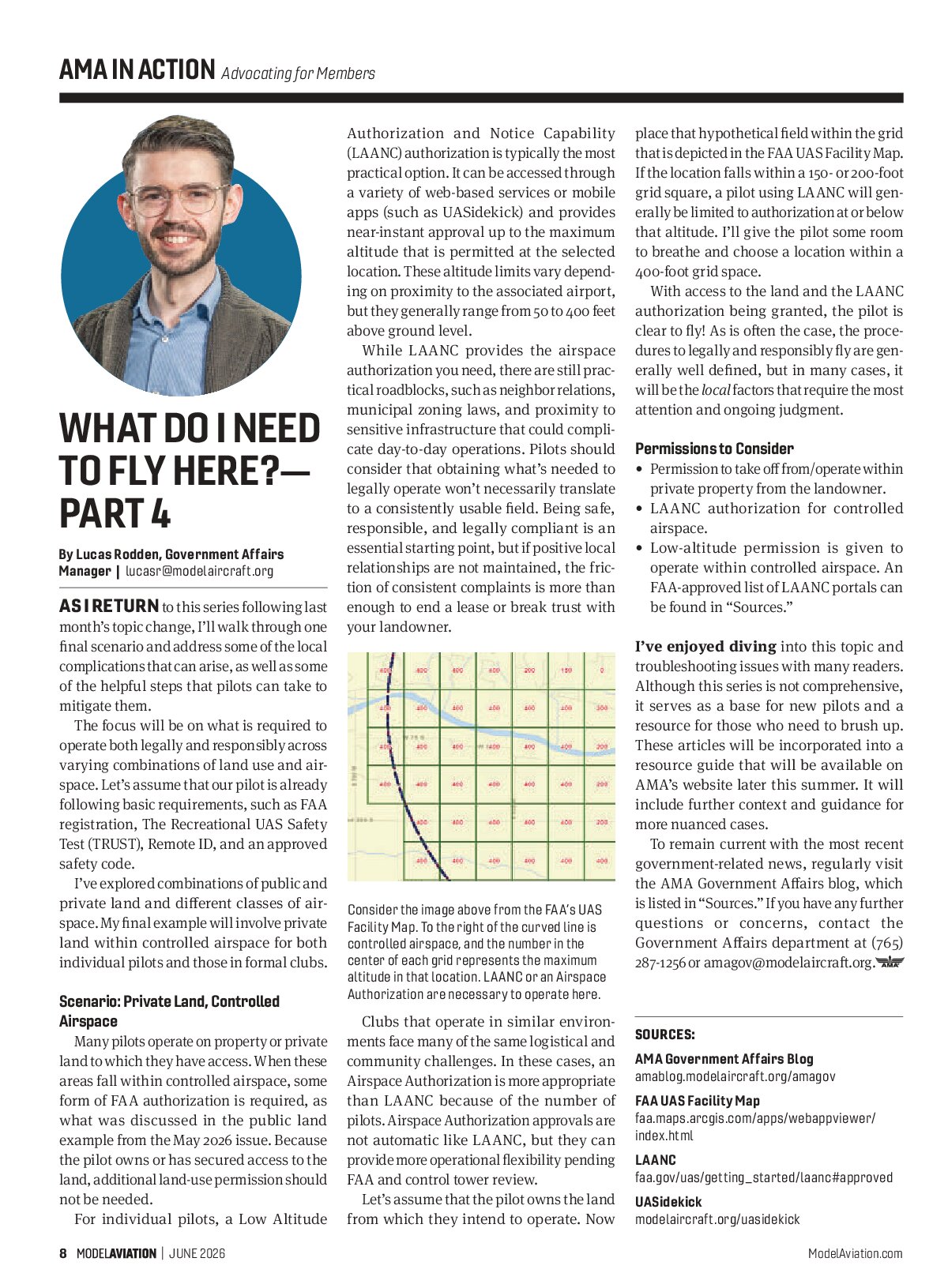
Let’s assume that the pilot owns the land from which they intend to operate. Now place that hypothetical field within the grid that is depicted in the FAA UAS Facility Map. If the location falls within a 150- or 200-foot grid square, a pilot using LAANC will generally be limited to authorization at or below that altitude. I’ll give the pilot some room to breathe and choose a location within a 400-foot grid space.
With access to the land and the LAANC authorization being granted, the pilot is clear to fly! As is often the case, the procedures to legally and responsibly fly are generally well defined, but in many cases, it will be the local factors that require the most attention and ongoing judgment.
Permissions to Consider
- Permission to take off from/operate within private property from the landowner.
- LAANC authorization for controlled airspace.
- Low-altitude permission is given to operate within controlled airspace. An FAA-approved list of LAANC portals can be found in “Sources.”
I’ve enjoyed diving into this topic and troubleshooting issues with many readers. Although this series is not comprehensive, it serves as a base for new pilots and a resource for those who need to brush up. These articles will be incorporated into a resource guide that will be available on AMA’s website later this summer. It will include further context and guidance for more nuanced cases.
To remain current with the most recent government-related news, regularly visit the AMA Government Affairs blog, which is listed in “Sources.” If you have any further questions or concerns, contact the Government Affairs department at (765) 287-1256 or amagov@modelaircraft.org.

SOURCES
- AMA Government Affairs Blog
- amablog.modelaircraft.org/amagov
- FAA UAS Facility Map
- faa.maps.arcgis.com/apps/webappviewer/index.html
- LAANC
- faa.gov/uas/getting_started/laanc#approved
- UASidekick
- modelaircraft.org/uasidekick