ADVANCED FLIGHT TECHNOLOGIES

SURF'S UP
By Patrick Sherman
lucidity@roswellflighttestcrew.com
APART FROM the required technical skill to operate the equipment and being in the right place at the right time, successful photography results from a combination of three factors: patience, observation, and dumb luck. On the rarest of occasions, one of these alone will be sufficient to capture a truly stirring image, while two increase your chances—but generally, all three are required.
Layer on top of this the fact that you are using a small unmanned aircraft system (sUAS; otherwise known as a drone) and the calculation becomes even more complex. You need to remember that you are a pilot first and a photographer second, meaning that the imperatives of capturing a compelling image must never override the fundamental commitment to the safety of flight that all pilots share.
Furthermore, the ingredients that make up a good photograph—most notably, patience—are often at cross purposes with the requirements of flight, where the countdown clock on your battery starts ticking the moment your propellers start turning.
This intractable pressure can lead to two different types of errors. First, you might rush an image to capture it before your battery gets too low, such that the resulting image is not as strong as it could have been. Second—and much more likely—you linger longer than you should to capture the perfect shot, running dangerously short on power.
Like Never Before
By the way, I am not positing that any of my photographs that accompany this article are excellent, stirring, or compelling. I judge them to be middling
efforts, but the process of capturing them caused me to reflect on these truths about aerial photography, and I thought that made them worth sharing.
The development of sUAS has created a fundamentally new capability, previously unknown in all the world: a type of intimate aerial photography that could not be achieved using other types of flying machines. To be sure, filmmakers have mounted their cameras onto airplanes and helicopters for decades and have captured spectacular results, but safety and the practical limitations of that technology meant that there were still limits—you couldn’t capture video a few feet above the salty spray where surfers were riding the waves.
As it happens, achieving precisely that was one of the first ideas that I had when I began experimenting with what would become small, civilian UAS technology 15 years ago.

I thought it would be amazing to capture a close-up perspective on surfers as they maneuvered among the breakers.
I’m well aware by now that there are daring sUAS pilots who must burn through more aircraft in a weekend than I have in my entire career, capturing jaw-dropping imagery of professional surf competitions. I’m certainly not claiming to perform at their level; however, on a recent trip to Southern California with a few hours to spare, I decided to try it out for myself.
Safety First
With a few feet of hours to spare before my airplane departed from San Diego, I drove north to the coastal town of Carlsbad, the home to Tamarack Surf Beach. Before I
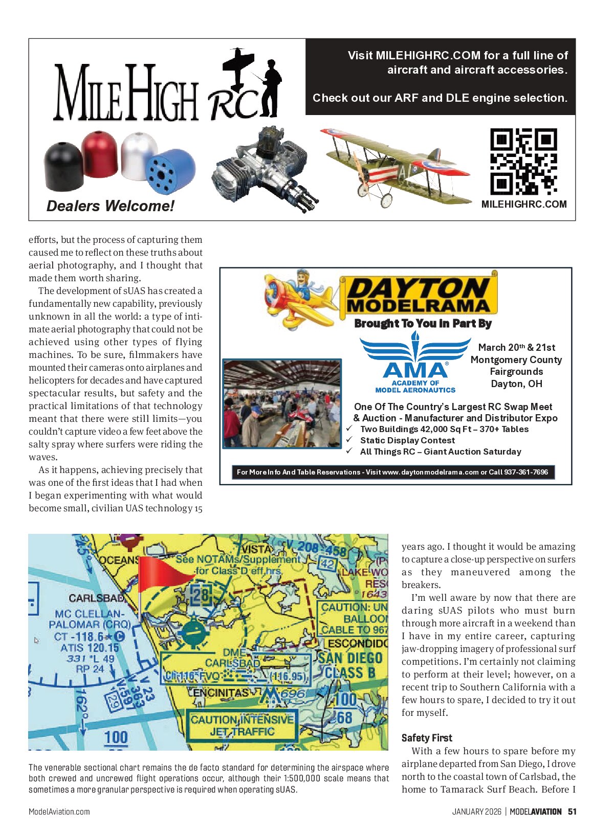
The venerable sectional chart remains the de facto standard for determining the airspace where both crewed and uncrewed flight operations occur, although their 1:50,000 scale means that sometimes a more granular perspective is required when operating sUAS.
ADVANCED FLIGHT TECHNOLOGIES

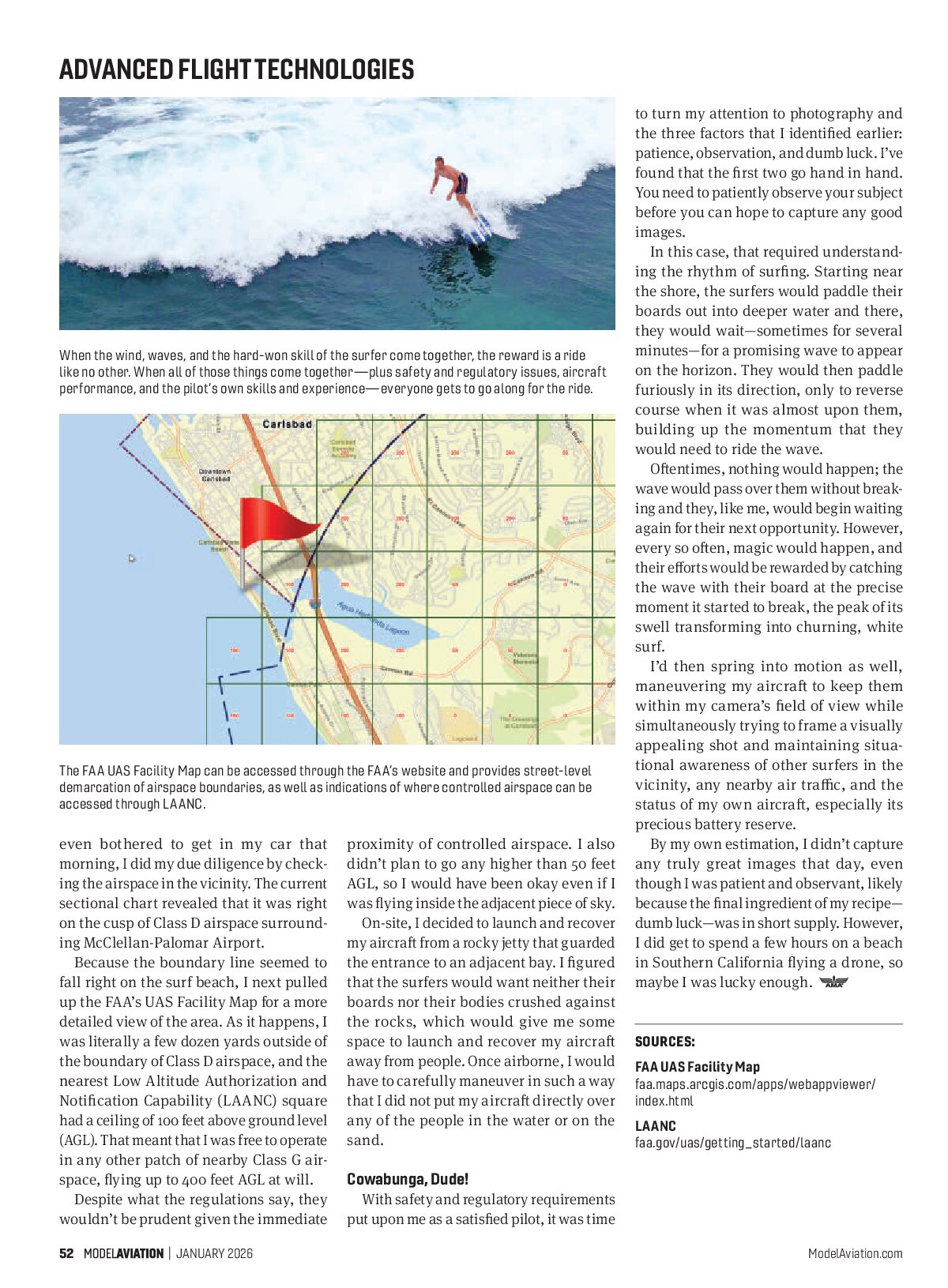
When the wind, waves, and the hard-won skill of the surfer come together, the reward is a ride like no other. When all of those things come together—plus safety and regulatory issues, aircraft performance, and the pilot’s own skills and experience—everyone gets to go along for the ride.

even bothered to get in my car that morning, I did my due diligence by checking the airspace in the vicinity. The current sectional chart revealed that it was right on the cusp of Class D airspace surrounding McClellan-Palomar Airport.
Because the boundary line seemed to fall right on the surf beach, I next pulled up the FAA’s UAS Facility Map for a more detailed view of the area. As it happens, I was literally a few dozen yards outside of the boundary of Class D airspace, and the nearest Low Altitude Authorization and Notification Capability (LAANC) square had a ceiling of 100 feet above ground level (AGL). That meant that I was free to operate in any other patch of nearby Class G airspace, flying up to 400 feet AGL at will.
Despite what the regulations say, they wouldn’t be prudent given the immediate proximity of controlled airspace. I also didn’t plan to go any higher than 50 feet AGL, so I would have been okay even if I was flying inside the adjacent piece of sky.
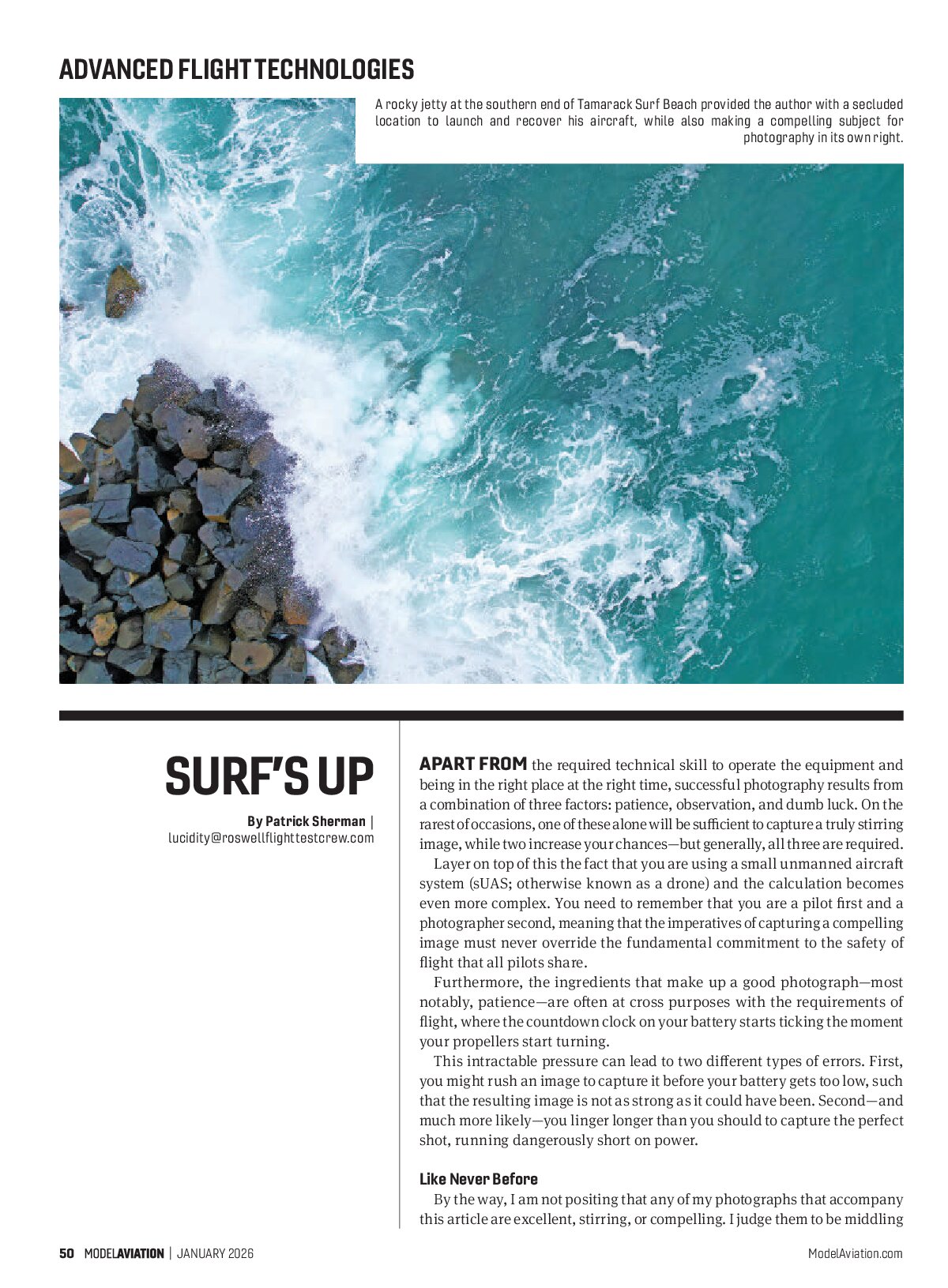
On-site, I decided to launch and recover my aircraft from a rocky jetty that guarded the entrance to an adjacent bay. I figured that the surfers would want neither their boards nor their bodies crushed against the rocks, which would give me some space to launch and recover my aircraft away from people. Once airborne, I would have to carefully maneuver in such a way that I did not put my aircraft directly over any of the people in the water or on the sand.
Cowabunga, Dude!
With safety and regulatory requirements put upon me as a satisfied pilot, it was time to turn my attention to photography and the three factors that I identified earlier: patience, observation, and dumb luck. I’ve found that the first two go hand in hand. You need to patiently observe your subject before you can hope to capture any good images.
In this case, that required understanding the rhythm of surfing. Starting near the shore, the surfers would paddle their boards out into deeper water and there, they would wait—sometimes for several minutes—for a promising wave to appear on the horizon. They would then paddle furiously in its direction, only to reverse course when it was almost upon them, building up the momentum that they would need to ride the wave.
Oftentimes, nothing would happen; the wave would pass over them without breaking and they, like me, would begin waiting again for their next opportunity. However, every so often, magic would happen, and their efforts would be rewarded by catching the wave with their board at the precise moment it started to break, the peak of its swell transforming into churning, white surf.
I’d then spring into motion as well, maneuvering my aircraft to keep them within my camera’s field of view while simultaneously trying to frame a visually appealing shot and maintaining situational awareness of other surfers in the vicinity, any nearby air traffic, and the status of my own aircraft, especially its precious battery reserve.
By my own estimation, I didn’t capture any truly great images that day, even though I was patient and observant, likely because the final ingredient of my recipe—dumb luck—was in short supply. However, I did get to spend a few hours on a beach in Southern California flying a drone, so maybe I was lucky enough.
SOURCES:
FAA UAS Facility Map
faa.maps.arcgis.com/apps/webappviewer/index.html
LAANC
faa.gov/uas/getting_started/laanc