THE WANDERING POLE

By Patrick Sherman | lucidity@roswellflighttestcrew.com
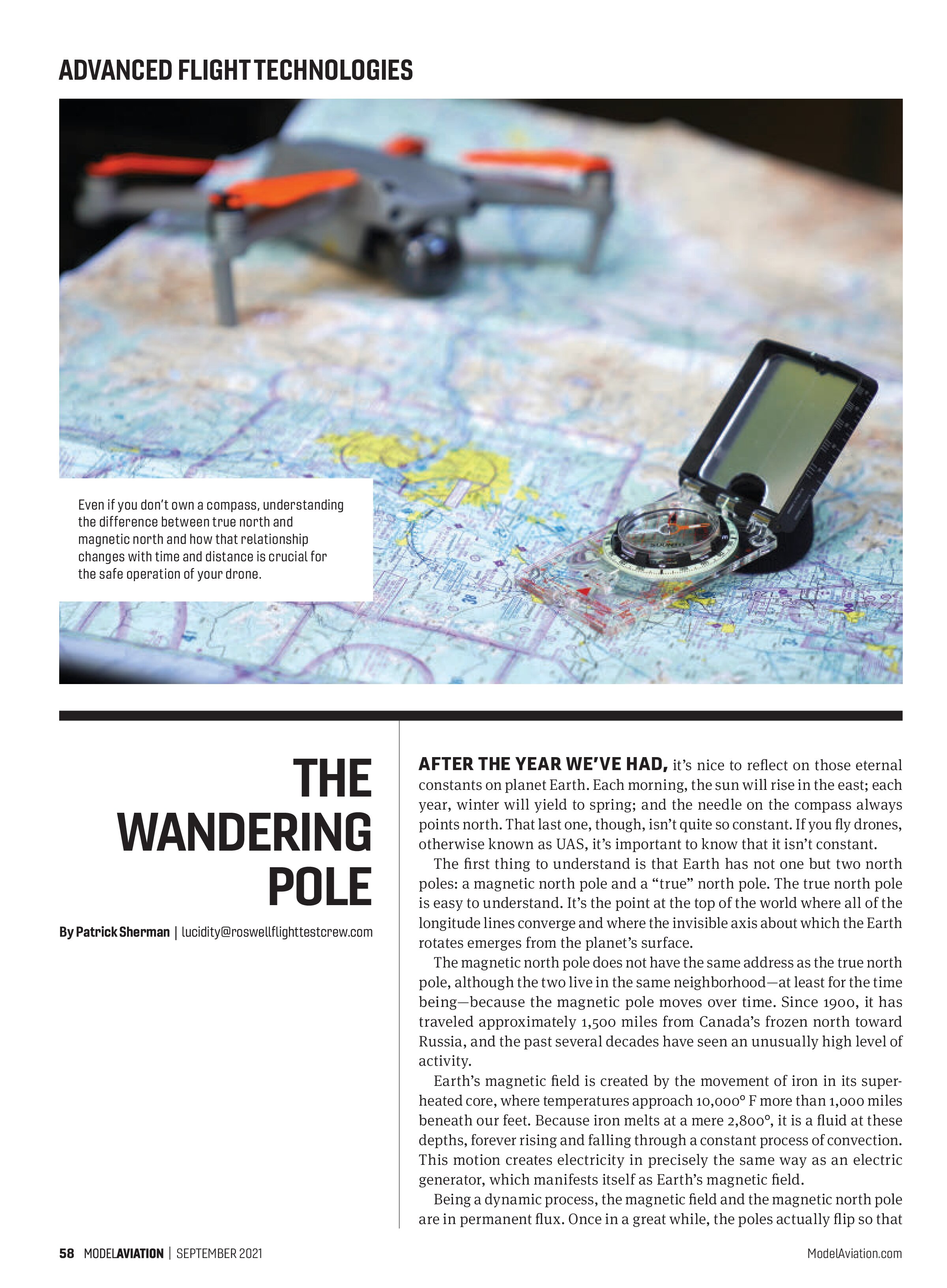
AFTER THE YEAR WE’VE HAD, it’s nice to reflect on those eternal constants on planet Earth. Each morning, the sun will rise in the east; each year, winter will yield to spring; and the needle on the compass always points north. That last one, though, isn’t quite so constant. If you fly drones, otherwise known as UAS, it’s important to know that it isn’t constant.
The first thing to understand is that Earth has not one but two north poles: a magnetic north pole and a “true” north pole. The true north pole is easy to understand. It’s the point at the top of the world where all of the longitude lines converge and where the invisible axis about which the Earth rotates emerges from the planet’s surface.
The magnetic north pole does not have the same address as the true north pole, although the two live in the same neighborhood—at least for the time being—because the magnetic pole moves over time. Since 1900, it has traveled approximately 1,500 miles from Canada’s frozen north toward Russia, and the past several decades have seen an unusually high level of activity.
Earth’s magnetic field is created by the movement of iron in its super-heated core, where temperatures approach 10,000° F more than 1,000 miles beneath our feet. Because iron melts at a mere 2,800°, it is a fluid at these depths, forever rising and falling through a constant process of convection. This motion creates electricity in precisely the same way as an electric generator, which manifests itself as Earth’s magnetic field.
Being a dynamic process, the magnetic field and the magnetic north pole are in permanent flux. Once in a great while, the poles actually flip so that the “north” pole is located in Antarctica. If you are around the next time that happens, buying a new compass is going to be the least of your worries. However, before I examine that extreme scenario, let’s look at what these ongoing changes mean for us as remote pilots.
Circling the Bowl
It’s a ritual that dates to the dawn of the small UAS. Known as the “compass dance,” it involves picking up your aircraft and turning it around and around in various orientations until its lights blink green or its interface app tells you to stop. When you perform the compass dance, typically at the request of your aircraft, you are giving it the opportunity to sense the flow of Earth’s magnetic field and calibrate its internal compass as to what north looks like in your local area.
Failing to perform the compass dance (or performing it incorrectly) can result in a phenomenon referred to by experienced remote pilots as TBE: the “toilet-bowl effect.” Once airborne, a drone with a compass that is improperly calibrated will follow a distinctive, swirling pattern through the sky when it should be hovering. Inside your flying machine’s poor, beleaguered brain—its flight control system—the compass and the GPS receiver argue about which direction is north, and that argument plays out as the TBE.
If you are a victim of the TBE, remain calm and recognize that you are not alone. Many pilots experience it. Land safely as soon as you are able and recalibrate your aircraft compass. As you do so, take care that there are no metal objects on your person or in your immediate vicinity that could distort the magnetic field in your local area. When your aircraft signals that the process is complete, resume flying.
You should expect to perform the compass dance at least once a year, and more frequently if you travel. Annually calibrating your compass accounts for the movement of the magnetic north pole and the resulting changes in the Earth’s magnetic field lines, known as magnetic declination. Other compass users, including backcountry hikers, must also account for magnetic declination, turning a small screw on the back of their compasses to account for those same changes.
Declination Nation
If you travel an appreciable distance from home (I use 500 miles as a rule of thumb), you should also recalibrate your compass. The reason is that Earth’s magnetic field lines are not uniform across the planet’s surface. They bend, twist, and loop as they travel from north to south. These geographic variations are frequently larger than annual shifts in magnetic declination; therefore, they are important to consider.
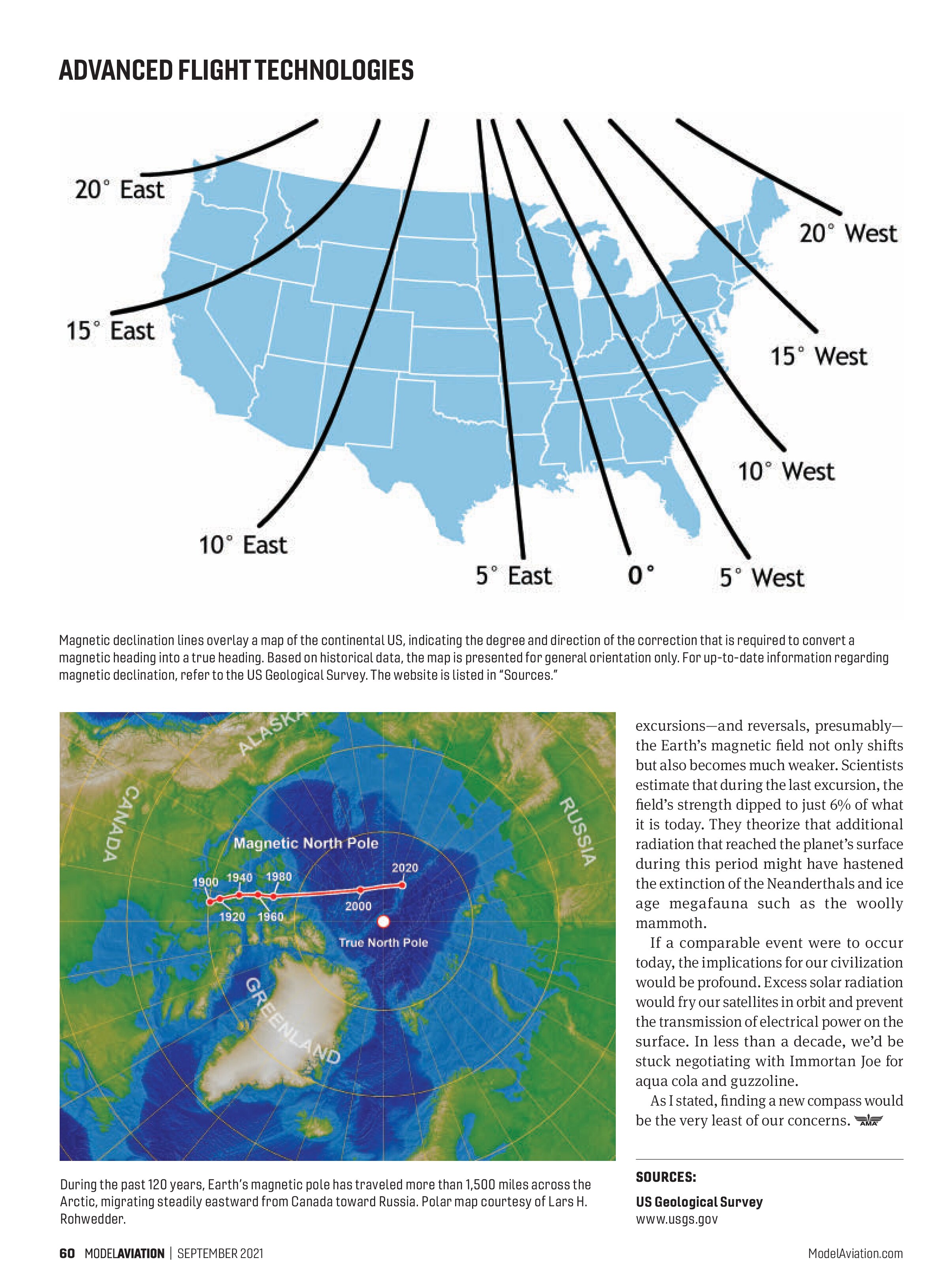
Each year, the US Geological Survey publishes a map, similar to the one that accompanies this article, showing the shape of the magnetic field lines throughout the country. Note that the lines on this map do not show the direction that a compass would point, indicating true north. Rather, they define the degree of correction that is required at any particular location.
To make matters more confusing, the magnetic declination lines across the western US are defined as east and the ones across the eastern US are defined as west. Divorced from their typical geographic meanings, east and west declination indicates the direction of the correction that is required to make a magnetic compass read true north.
An east declination indicates that the value should be subtracted from a magnetic heading to yield a true heading. West declination means the opposite. Add the value to a magnetic heading to yield a true heading. A mnemonic that is widely used by pilots to remember whether to add or subtract is: “East is least, west is best,” with “least” corresponding with subtraction and “best” corresponding with addition.
One final factor to keep in mind is that there can also be highly localized variations in magnetic fields of no more than a few miles across. These are noted on aeronautical charts.
The Big Flip
The most extreme manifestation of the variations that occur in Earth’s magnetic field is a magnetic reversal, when the “north” pole moves to the southern hemisphere. By studying deposits on the ocean floor where lava emerges from vents then cools and locks in the orientation of iron-bearing minerals, scientists have been able to determine that the Earth has endured 183 reversals throughout the past 83 million years. The most recent one occurred approximately 800,000 years ago, so these are not events that occur on a human timescale.
When a reversal does take place, scientists estimate that it takes between 2,000 and 12,000 years to be complete. A similar phenomenon, known as a magnetic excursion, occurs more frequently and in a much shorter time frame. During the course of just a few hundred years, the north pole takes a walkabout but eventually settles back into what we regard as its familiar home.
The most recent excursion took place close to 42,000 years ago. During


excursions—and reversals, presumably—the Earth’s magnetic field not only shifts but also becomes much weaker. Scientists estimate that during the last excursion, the field’s strength dipped to just 6% of what it is today. They theorize that additional radiation that reached the planet’s surface during this period might have hastened the extinction of the Neanderthals and ice age megafauna such as the woolly mammoth.
If a comparable event were to occur today, the implications for our civilization would be profound. Excess solar radiation would fry our satellites in orbit and prevent the transmission of electrical power on the surface. In less than a decade, we’d be stuck negotiating with Immortan Joe for aqua cola and guzzoline.
As I stated, finding a new compass would be the very least of our concerns.
SOURCES:
US Geological Survey
www.usgs.gov