RC SLOPE SOARING
AMAZING
PLACES
By Greg Schutte | gshooty@yahoo.com
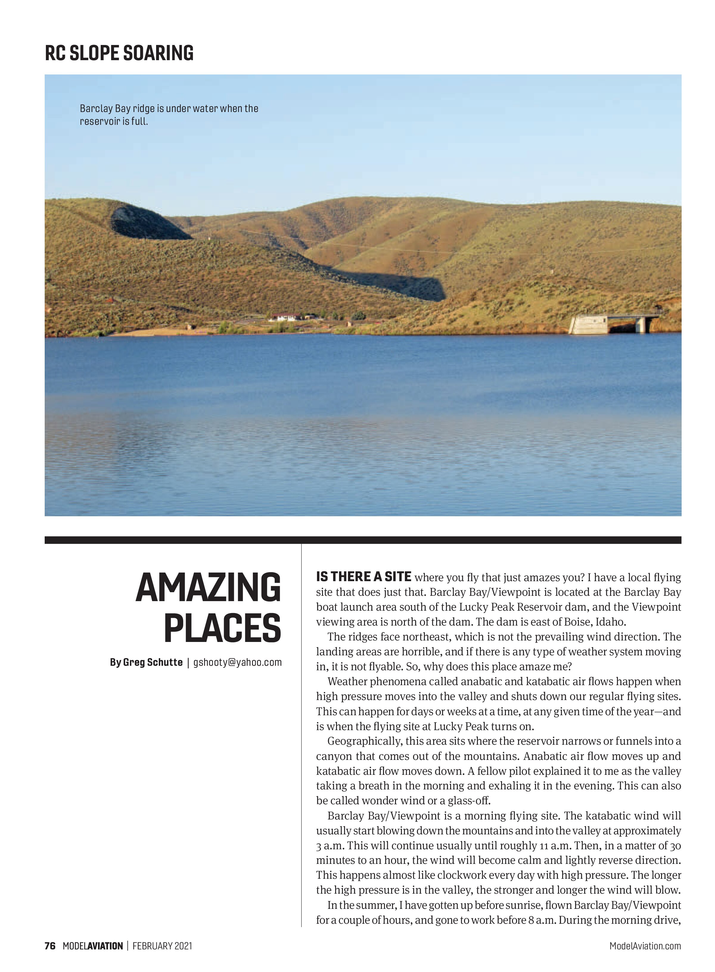
IS THERE A SITE where you fly that just amazes you? I have a local flying site that does just that. Barclay Bay/Viewpoint is located at the Barclay Bay boat launch area south of the Lucky Peak Reservoir dam, and the Viewpoint viewing area is north of the dam. The dam is east of Boise, Idaho.
The ridges face northeast, which is not the prevailing wind direction. The landing areas are horrible, and if there is any type of weather system moving in, it is not flyable. So, why does this place amaze me?
Weather phenomena called anabatic and katabatic air flows happen when high pressure moves into the valley and shuts down our regular flying sites. This can happen for days or weeks at a time, at any given time of the year—and is when the flying site at Lucky Peak turns on.
Geographically, this area sits where the reservoir narrows or funnels into a canyon that comes out of the mountains. Anabatic air flow moves up and katabatic air flow moves down. A fellow pilot explained it to me as the valley taking a breath in the morning and exhaling it in the evening. This can also be called wonder wind or a glass-off.
Barclay Bay/Viewpoint is a morning flying site. The katabatic wind will usually start blowing down the mountains and into the valley at approximately 3 a.m. This will continue usually until roughly 11 a.m. Then, in a matter of 30 minutes to an hour, the wind will become calm and lightly reverse direction. This happens almost like clockwork every day with high pressure. The longer the high pressure is in the valley, the stronger and longer the wind will blow.
In the summer, I have gotten up before sunrise, flown Barclay Bay/Viewpoint for a couple of hours, and gone to work before 8 a.m. During the morning drive,

there will be no wind in the valley. As soon as you enter the canyon, the wind will pick up from calm to 10 to 20-plus mph. You only drive a couple of miles up through the canyon to Barclay Bay. If you continue to drive up the reservoir approximately 4 to 5 miles into the mountains, the wind will be calm again.
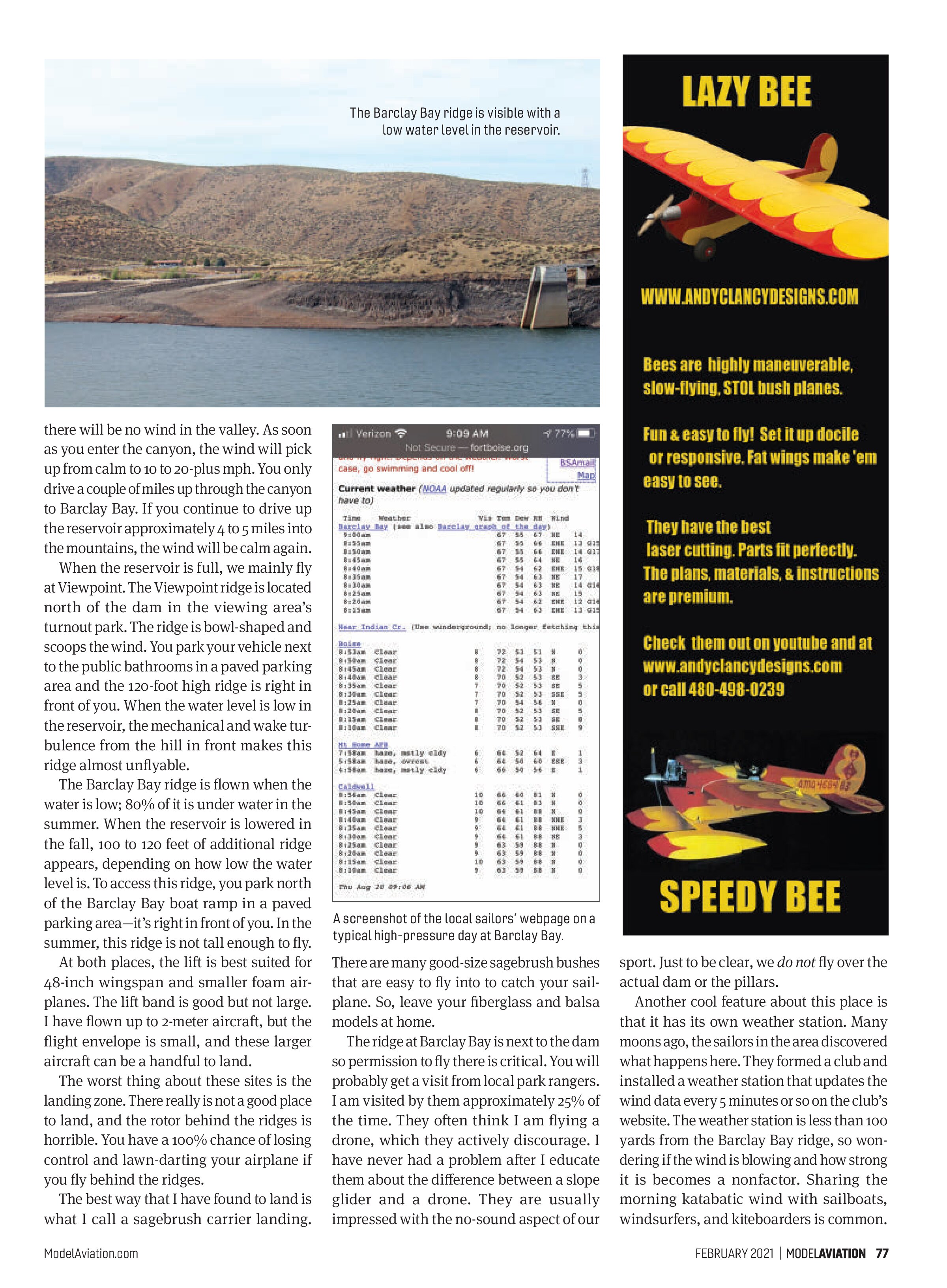
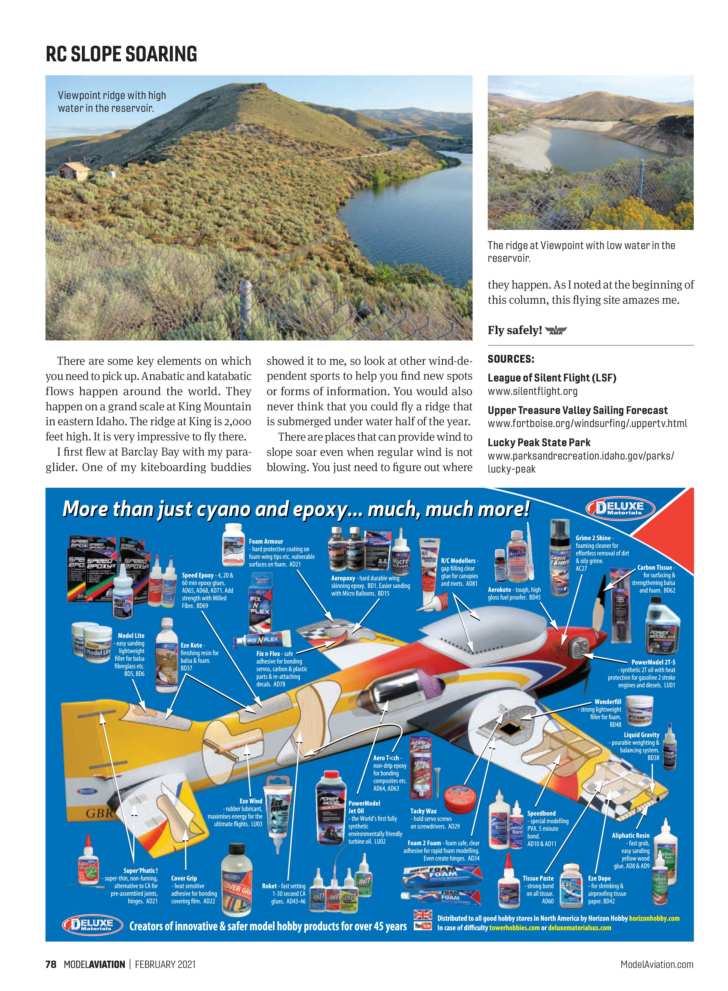
When the reservoir is full, we mainly fly at Viewpoint. The Viewpoint ridge is located north of the dam in the viewing area’s turnout park. The ridge is bowl-shaped and scoops the wind. You park your vehicle next to the public bathrooms in a paved parking area and the 120-foot high ridge is right in front of you. When the water level is low in the reservoir, the mechanical and wake turbulence from the hill in front makes this ridge almost unflyable.
The Barclay Bay ridge is flown when the water is low; 80% of it is under water in the summer. When the reservoir is lowered in the fall, 100 to 120 feet of additional ridge appears, depending on how low the water level is. To access this ridge, you park north of the Barclay Bay boat ramp in a paved parking area—it’s right in front of you. In the summer, this ridge is not tall enough to fly.
At both places, the lift is best suited for 48-inch wingspan and smaller foam airplanes. The lift band is good but not large. I have flown up to 2-meter aircraft, but the flight envelope is small, and these larger aircraft can be a handful to land.
The worst thing about these sites is the landing zone. There really is not a good place to land, and the rotor behind the ridges is horrible. You have a 100% chance of losing control and lawn-darting your airplane if you fly behind the ridges.
The best way that I have found to land is what I call a sagebrush carrier landing.

There are many good-size sagebrush bushes that are easy to fly into to catch your sailplane. So, leave your fiberglass and balsa models at home.
The ridge at Barclay Bay is next to the dam so permission to fly there is critical. You will probably get a visit from local park rangers. I am visited by them approximately 25% of the time. They often think I am flying a drone, which they actively discourage. I have never had a problem after I educate them about the difference between a slope glider and a drone. They are usually impressed with the no-sound aspect of our sport. Just to be clear, we do not fly over the actual dam or the pillars.
Another cool feature about this place is that it has its own weather station. Many moons ago, the sailors in the area discovered what happens here. They formed a club and installed a weather station that updates the wind data every 5 minutes or so on the club’s website. The weather station is less than 100 yards from the Barclay Bay ridge, so wondering if the wind is blowing and how strong it is becomes a nonfactor. Sharing the morning katabatic wind with sailboats, windsurfers, and kiteboarders is common.


There are some key elements on which you need to pick up. Anabatic and katabatic flows happen around the world. They happen on a grand scale at King Mountain in eastern Idaho. The ridge at King is 2,000 feet high. It is very impressive to fly there.
I first flew at Barclay Bay with my paraglider. One of my kiteboarding buddies
showed it to me, so look at other wind-dependent sports to help you find new spots or forms of information. You would also never think that you could fly a ridge that is submerged under water half of the year.
There are places that can provide wind to slope soar even when regular wind is not blowing. You just need to figure out where
they happen. As I noted at the beginning of this column, this flying site amazes me.
Fly safely!
SOURCES:
League of Silent Flight (LSF)
www.silentflight.org
Upper Treasure Valley Sailing Forecast
www.fortboise.org/windsurfing/.uppertv.html
Lucky Peak State Park
www.parksandrecreation.idaho.gov/parks/lucky-peak